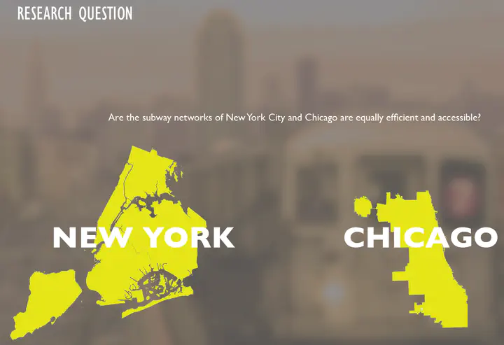
Efficiency and Accessibility of NYC and Chicago Subway networks
Network Analysis - Advanced GIS study (May, 2015)
As wealth gaps increase in American Cities certain lower income populations in cities will grow more vulnerable if their transportation
needs are not met. We can use GIS to spatially research where the
highly dense areas are that may be currently underserved by existing
Subway infrastructure in cities. By identifying which residential and business zones in cities are accessible and which are being adequately
served in their transportation needs, we can better indentify patterns
of where to target permanent transportation infrastructure development
in the future.
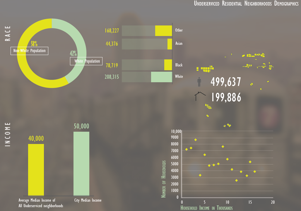
By identifying which residential and business zones in cities are accessible and which are being adequately served in their transportation needs, we can better identify patterns of where to target permanent transportation infrastructure development in the future. Analyzing the under-serviced residential areas in terms of their demographics and composition gave the following result: The overall median income is lower than that of the city and there is more non-white population in these tracts. Though these differences
are visible, they aren’t very significant.
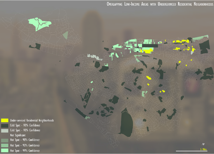
Studying the under-serviced residential areas on the basis of house-hold income and race the conclusion was that there is almost no overlap of low-income and racially minor neighborhoods on these and hence
no income-based or race-based discrimination is observed.
The scope of the project included subway networks out of the entire transit network system, further similar
analysis of bus routes etc can lead to results for transit efficiency as a whole.
Please use the link here if the pdf embed does not load: Project report
Mehak Sachdeva
Assistant Professor of Urban Science
My research interests include spatial statistical methods with applications in the social, urban and environmental sciences.